Updated on August 23rd, 2025.
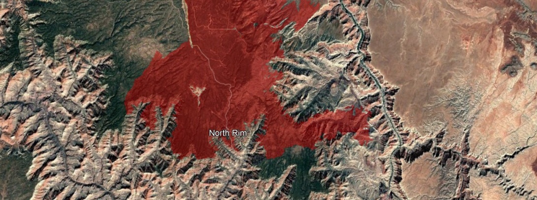
The Dragon Bravo Fire is now over 60% contained per InciWeb. One of the worst wildfires in Arizona history responsible for the loss of a lot of historic structures on the North Rim of Grand Canyon. Wildfire | InciWeb
July and most of August have been exceptionally dry for northern AZ. The first major threat of floods is starting today (August 23rd, 2025) and will extend for almost a week as a deep plume of monsoon moisture moves into northern AZ. We are likely to see the Dragon Bravo Fire extinguished and some significant flash floods hitting the Grand Canyon's north side. I never intended for this blog post to track individual weather systems, but this is probably the first major threat for flash flooding since the fire started. The main goal here was to identify washes that were likely to flash flood from the burn scar. As the fire is mostly contained now and the margins haven't changed much since the original post, I won't be posting many updates here. The drainages identified below will be dangerous for the next few years.
A new flash flood watch has been posted by the NWS for the North Rim as of Saturday, the 23rd. This will likely be extended past Tuesday as things don't look to dry out until Thursday the 28th.

Previous Discussion:
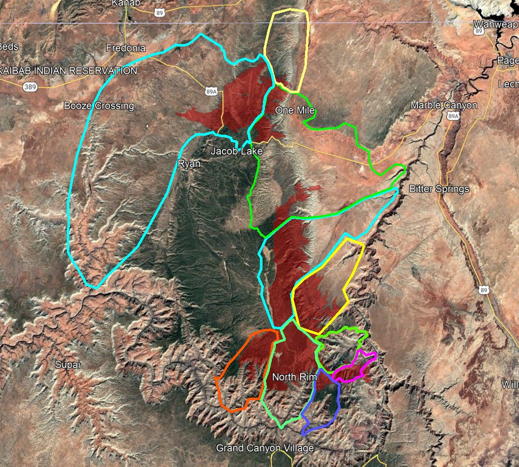
Of course, the threat of flooding is completely contingent on rain showing up. The location of the rain and the rainfall totals over time are what matter here. This is not meant to be an alarmist blog post, but to sleuth out which washes / canyons / rivers are most prone to large flash floods post Dragon Bravo Fire. These burn scars typically stay dangerous for over a year after the fire is burnt out, before the vegetation has a chance to rebound. The typical absorption potential of the forest soils is greatly modified after a large forest fire. These soils become hydrophobic, so it requires a lot less rain than typical to generate a large flash flood. The southwest monsoon season "officially" ends on September 30th, but that doesn't mean the threat of heavy rain ends with it. There is a transition season in the spring and fall when the jet stream is migrating north and south which can trigger major rainfall events well before and after the official timespan of the monsoon. People recreating in the Grand Canyon in the vicinity of this burn scar should be highly cognizant of the dangers it poses. Burn scars can cause some truly massive flash floods. This includes raft trips picking out camp sites and people hiking these canyons looking for camp sites. It is never a good idea to camp near or in dry washes and rivers in the region during monsoon. The rains that trigger flash floods can hit dozens of miles upstream and the floods can show up many hours after the rain has gone.
HOUSE ROCK WASH
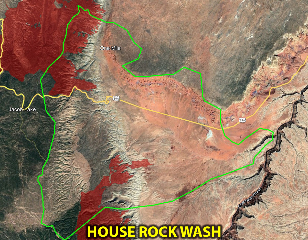
This wash drains a large portion of bentonite clays and the very steep slickrock face of the Vermilion Cliffs. What I did not initially catch here on Aug 10th is that this drainage has been impacted by two separate wildfires recently. The White Sage Fire to the North and the Dragon Bravo Fire to the South. Combined, these make up a large burn scar > 30 square miles in area. This poses an increased flash flood threat at the junction of the Colorado and also where the wash crosses highway 89A to coming down from the burred areas of the White Sage Fire.
COYOTE WASH / WIRE PASS & WAVE
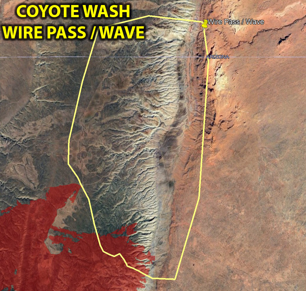
This is a small drainage above the Wire Pass entrance to Buckskin Gulch and the trail head for the Wave. A small area at the top of the catchment for this drainage does have some burn scar from the White Sage Fire. This is a sensitive area because it gets a lot of tourist traffic for people visiting The Wave, Wire Pass, and Buckskin Gulch. There is a slightly increased risk or larger floods because of this small burn area.
NORTH CANYON WASH
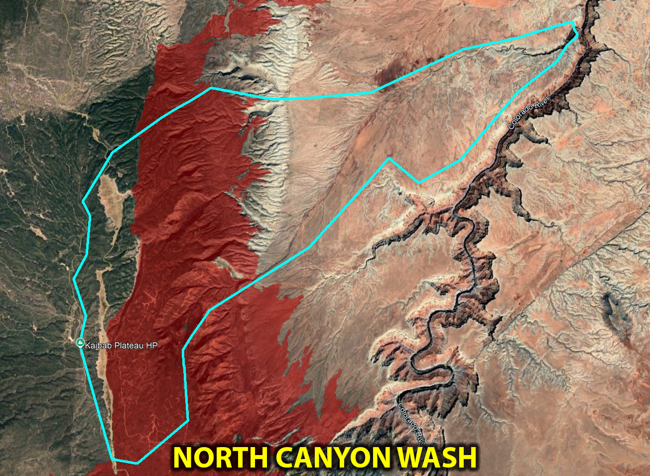
North Canyon Wash. This drainage is massive, and a major flash flood threat without the burn scar. As of Aug 10th, the catchment of this wash is draining over 50 square miles of burn scar. I'd consider this a major threat for large flash floods moving into late monsoon. The elevation change of the Kaibab Plateau against the low canyonlands here is also a focal point for thunderstorms. The plateau creates a forcing mechanism which gives the storms an extra lift/boost which can cause them to park right over the burn scar area. A flash flood generated in this area of the burn scar could take a few hours to reach the Colorado River below.
SOUTH CANYON WASH
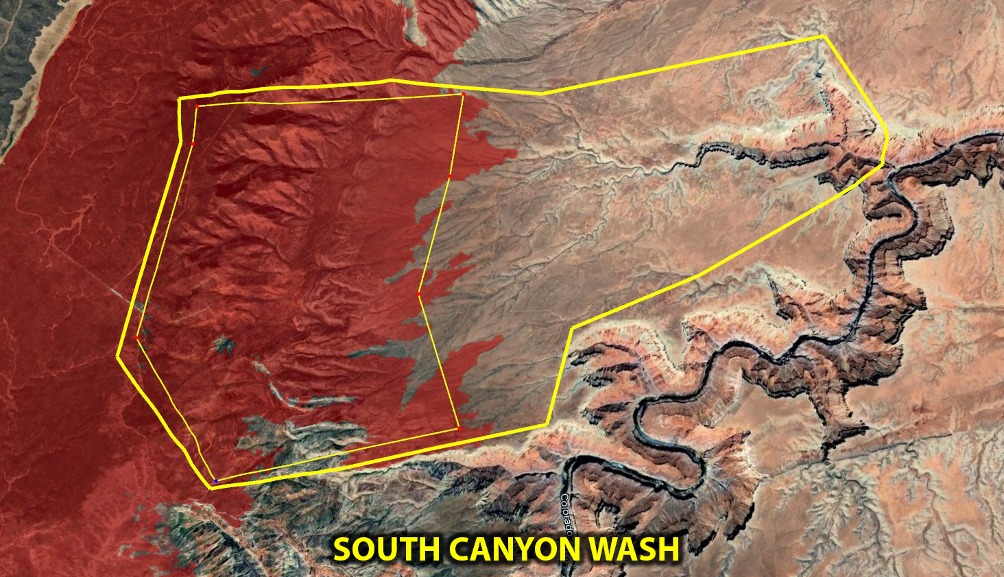
The next wash down river, South Canyon Wash, also drains a significant area of burn scar. While not as much as North Canyon Wash, it is well over 30 square miles. I would consider flash flood risk highly elevated above normal for this wash.
NANKOWEAP / LITTLE NANKOWEAP
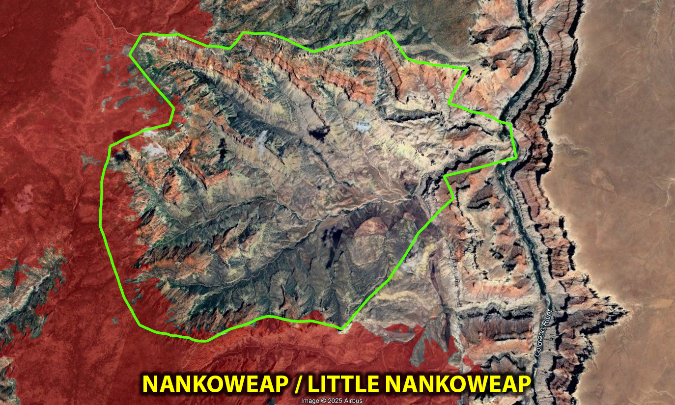
Nankoweap and Little Nankoweap are a large bowl-shaped drainage that terminate in steep cliffs at the plateau. It appears that most of the drainage above these two at the plateau level flows off to the North and West - so not much of this drainage has burned soil above it. While it does drain a large area, and is a flood risk outside of a burn, I would say this drainage has a slightly elevated flood risk.
KWAGUNT CREEK & NEIGHBORS
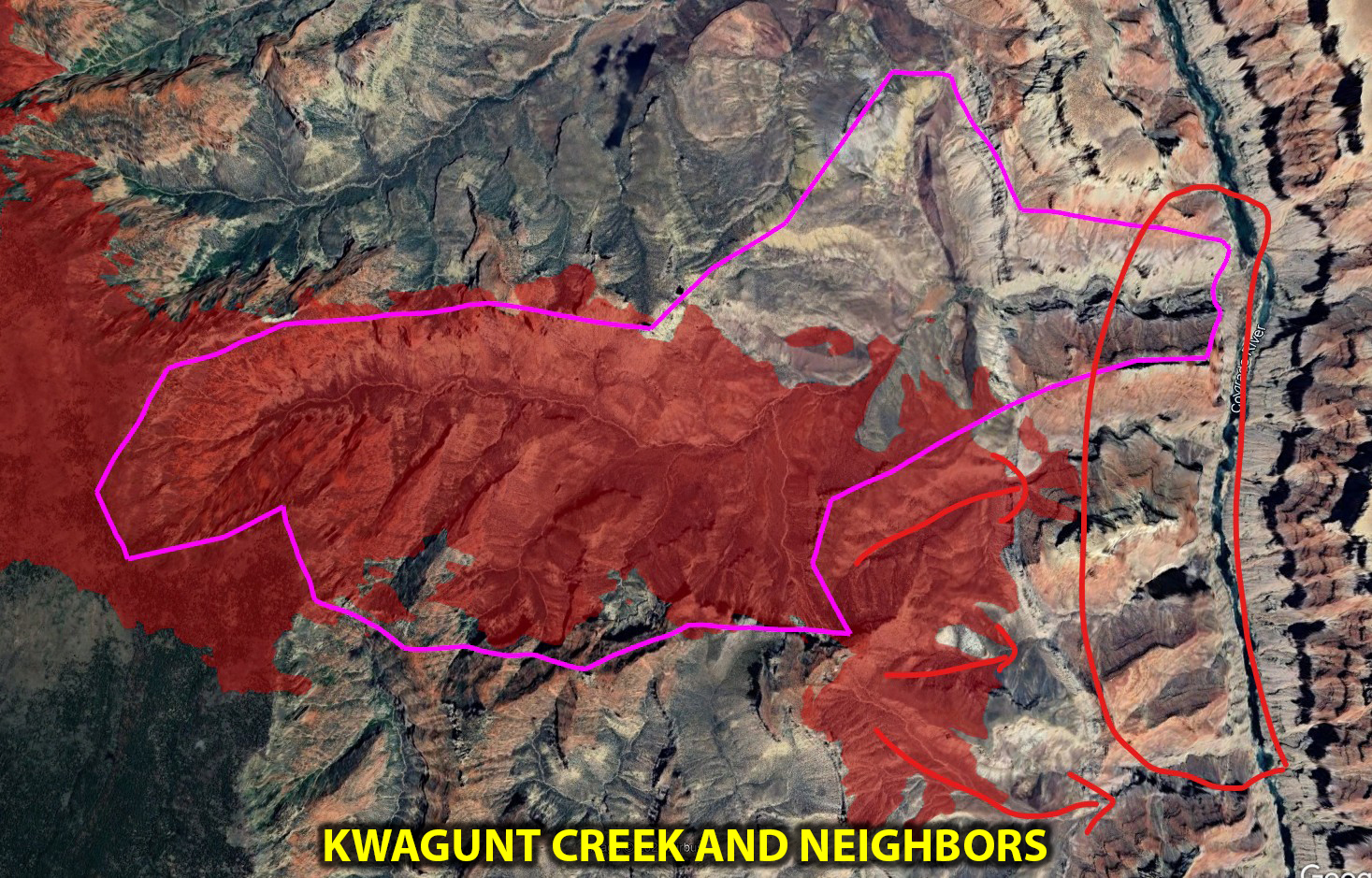
Kwagunt is a compact and relatively small drainage compared to some nearby. Over half of the catchment for Kwagunt has burnt. This greatly elevates the risk for a large flash flood for Kwagunt. There are also a few small washes just south of Kwagunt that also have some burn scars. This includes Malgosa Creek, Awatubi Creek, and Sixtymile Creek.
CLEAR CREEK
Clear Creek is a large drainage but has mostly dodged the fire as of Aug 10th. There is a decent size area of burn scar at the very top of the catchment that will elevate the flash flood risk moderately. The fire is not out yet, and if it continues to burn along the peninsula above Clear Creek the flood threat will increase.
BRIGHT ANGEL CANYON / PHANTOM RANCH
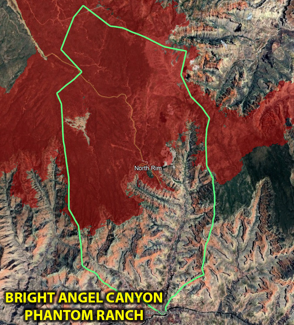
I have to say, I was taken aback when I mapped this drainage out and saw just how much of it has been charred by the Dragon Bravo Fire. This will probably be the biggest threat area for flash floods in the coming months, because it houses Phantom Ranch, accessible via Bright Angel Trail from the South. There is over 50 square miles of burn in the catchment of Bright Angel Canyon and its largest tributary which drops in just above Phantom Ranch. I would call the flash flood threat here highly elevated in the coming months, with the potential for some catastrophic damage if heavy rain hits on the plateau above the drainage. If you are planning on hiking Bright Angel Canyon / Phantom Ranch / Bright Angel Campground / North Kaibab Trail in the coming months, I'd make sure to check your forecasts before heading out. This is a dangerous setup.
CRYSTAL CREEK / TUNA CREEK
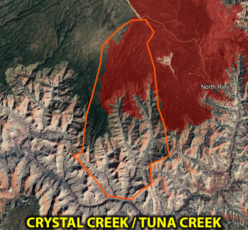
The last two washes I could identify that have an elevated flash flood risk are Crystal Creek and Tuna Creek. Both of these have extensive burn scars on the high end of their catchments.
KANAB CREEK
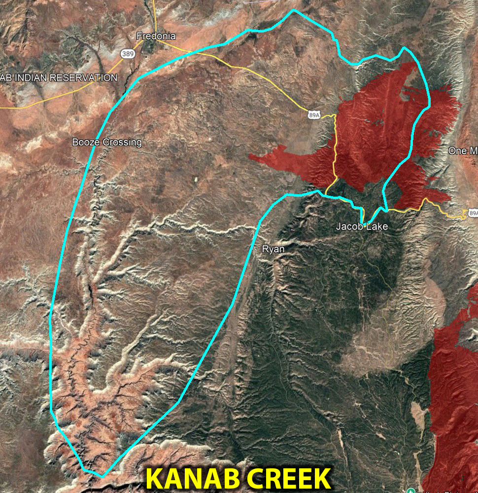
A large portion of the White Sage Fire is covering some of the catchment that eventually drains into Kanab Canyon and the Colorado River. The area of this burn scar is quite large, ~40 square miles. While the potential flood will have to travel quite a ways to make it past Fredonia and into Kanab Canyon, I can't see any reason why this wouldn't increase the flash flood threat along the wash from 89A to near Fredonia and farther down into Kanab Canyon and eventually the Colorado River junction.
UPDATES
Updated on August 13th. The Dragon Bravo fire hasn't changed much and is now > 40% contained with rain in the very near forecast.
Cheers,
David Rankin